
DWH1 became part of IGS tracking network in mid-June'02, and updated from
daily to hourly mid-July'03.
Statistics at
http://igscb.jpl.nasa.gov/network/site/dwh1.html
I also try to summarize analysis at
ftp://dsl.niceties.com/pub/igsdwh1.txt and igstdwh1.txt (final clock) and
igrtdwh1.txt (rapid clock)
I am logging "continuous" GPS/GLONASS dual-frequency observables using a simple mast bracketed to my house (not geodetic quality location; see below for photo and sky plot). This station DWH1 replaced old station DWH0 early Oct'00 (antenna moved to other wall of house which I think allows more observations and reduces multipath). Caveat: I am NOT a surveyor!
SEAW is a little over 16km to the SW, and LKCP is similar distance to the NE. DWH1's (ARP) ITRF97(1997.0) xyz is approximately -2280790.31 / -3638690.41 / 4700113.85; IERS DOMES number is 49837S001.
I'll log if I ever adjust the mast, and I interrupt for firmware upgrades (see details of interruptions below).
Data is in files with names like yyyy/xxx/dwh1/dwh1xxx0.yyd.Z at
ftp://dsl.niceties.com/pub/rinex/
where yyyy and yy is year digits and xxx is three digit day of year;
they include GLONASS and WAAS and typically you'll want to gzip -d then crx2rnx to create 30-second epoch RINEX
observation files (.yyo).
.yyh files are "navigation" files for WAAS (WAAS
observations can be removed with "teqc -S" if not allowed by your
processing software).
Four of the files are uploaded to
ftp://cddisa.gsfc.nasa.gov/pub/gps/gpsdata/
and two to SOPAC daily.
Feel free to email
me a request for GPS-only data instead of the combined GPS/GLONASS/WAAS
data; gpsonly/dwh1xxx0.00o.gz are such files. There are also dwha files
from collocated Ashtech Z-12 (sometimes since mid-2000, via antenna splitter).
That Z-12 is part of JPL's real-time network with a couple graphs at
http://gipsy.jpl.nasa.gov/igdg/demo/sites/dwha.html
Filenames like dwh1xxx0.yym (or with .gz added) are Met files from
Paroscientific's MET3A sensor.
Antenna is dual-depth choke-ring (JPSREGANT_DD_E), L1/L2 phase center around
.113M/.119M above ARP.
Oscillator is usually external 5MHz HP 5071A-001 cesium steered ~+7.5e-14; what I call UTC(dwh).
Please report any problems you might encounter processing the RINEX, so that I can pass along to Javad.
On Oct-10-2000, I established a similar station called tvb1 around 25km south near N47 33 15.8, W122 8 22.4 - it was dual-frequency GPS/GLONASS but JPSLEGANT_E (small groundplane) on a home roof, hooked to external frequency standard (currently HP 5071A cesium). Downloading schedule was irregular, and not necessarily as continuous as dwh1. TVB1 ARP was around 288.66m (.7?). In 2002 TVB1 switched to "TVB2" using different nearby antenna/receiver (Ashtech - no GLONASS).
Detailed log:
07/19/2003 - updated from daily to hourly
04/18/2003 10:34 - changed WAAS parameter to correct R03 P-code
~01/25/2003 - removed elevation mask (to allow logging new/unhealthy satellites;
not uploaded to CDDIS/SOPAC until ~mid-February)
12/20/2002 23:45 - updated to firmware 2.3 and started pseudorange smoothing
~11/21/2002 - entered pos/fix/alt after realizing recent missing data was due to
rare <4 satellites
11/01/2002 23:47 - updated to firmware 2.2p3
10/09/2002 03:31 - upgraded from 2-way passive WRInc splitter to 4-way active
GPSSource splitter (unity gain, high isolation)
06/28/2002 - started submitting S1 S2 observables (can add to older RINEX if
desired)
...
02/21/2002 06:56 - 2Hz 2nd order PLL
01/17/2002 18:32 - reinserted splitter
01/11/2002 00:09 - 4Hz 2nd order PLL
12/15/2001 21:30 - removed splitter
12/12/2001 23:58 - 2.2p1 firmware
11/24/2001 00:09 - 3Hz 2nd order PLL
08/25/2001 00:05 - Co-Op 3,3
08/20/2001 21:00 - cut down tree ~285 azimuth
08/14/2001 23:55 - 2.2pl1b6 firmware, 3Hz 2nd order PLL (and
updated PCCDU)
07/26/2001 00:01 - 4Hz 2nd order PLL (and updated PC)
07/24/2001 23:59 - 5Hz 2nd order PLL
07/23/2001 00:07 - 3Hz 2nd order PLL,
07/20/2001 23:59 - Co-Op
07/19/2001 23:59 - 3Hz PLL
07/17/2001 23:59 - Co-Op comm 9, ind 3
07/14/2001 00:00 - loosened PLL to 3Hz
07/07/2001 23:00 - (updated PC)
06/24/2001 00:01 - tightened PLL to 2Hz
06/15/2001 ~00:39 - tightened PLL to 3Hz
06/04/2001 13:40 - turned off Co-Op (5Hz PLL)
05/25/2001 03:03 - added antenna splitter
05/13/2001 23:55 - (Win2K updated to SP2)
05/07/2001 23:46 - upgraded firmware to 2.2r
04/30/2001 23:45 - upgraded firmware to 2.2 bt5, reset parms (mask was 10?)
04/19/2001 00:54 - comm 8, ind 2
04/15/2001 06:00 - comm 6, ind 2
03/30/2001 00:06 - comm 6, ind 4
03/25/2001 23:54 - comm 5, ind 5
03/22/2001 00:04 - comm 3, ind 3
03/16/2001 00:16 - comm 5, ind 3
03/12/2001 00:00 - comm 4, ind 3
03/07/2001 00:00 - comm 4, ind 4
02/28/2001 23:50 - upgraded firmware to 2.2 bt4, reset all NVRAM parameters
02/28/2001 18:55 - earthquake (probably moved few mm S and down?)
02/23/2001 ~23:00 - turned off carrier MPR
02/21/2001 23:19 - worked on PC for about 40 minutes
02/21/2001 20:58 - disconnected antenna cable ~56 minutes to improve connector
and shorten ~10 m
01/23/2001 23:55 - comm 5, ind 4
01/08/2001 00:05 - comm 6, ind 4
01/06/2001 00:13 - comm 5, ind 5
01/05/2001 00:03 - comm 4, ind 5
01/04/2001 00:05 - comm 4, ind 4
01/02/2001 00:00 - comm 3, ind 4
12/30/2000 20:45 - comm 2, ind 4
12/28/2000 23:55 - comm 2, ind 3
12/26/2000 23:55 - comm 2, ind 2
12/23/2000 23:58 - comm 3, ind 2
12/21/2000 00:58 - event lock on (new timing synchronization feature)
12/20/2000 00:01 - comm 4, ind 2
12/16/2000 23:59 - comm 5, ind 2
12/15/2000 ~23:45 - disconnect antenna to inspect connection
12/14/2000 ~23:15 - loose antenna connection?
12/10/2000 01:33 - comm 5, ind 3
12/08/2000 ~23:30 - flashed firmware (same?) and updated PC
11/18/2000 ~04:00 - loose antenna connection
11/17/2000 23:56 - comm 5, ind 4
11/15/2000 23:45 - comm 6, ind 3
11/13/2000 00:45 - comm 6, ind 5
11/11/2000 23:59 - com 4, ind 2
11/9/2000 00:09 - raised common to 4Hz?
11/6/2000 23:59 - lowered common to 3Hz
11/2/2000 23:58 - removed splitter
10/31/2000 23:58 - raised common to 5Hz
10/29/2000 23:59 - added 2-way antenna splitter
10/27/2000 23:55 - updated 2.2beta firmware and set to Co-Op common 4Hz,
individual 3Hz
10/26/2000 23:59 - reduced PLL to 2Hz
10/25/2000 12:30 - rearranged equipment rack
10/25/2000 00:00 - disabled Co-Op and set PLL to 5Hz
10/23/2000 23:59 - individual & common 5Hz again
10/23/2000 23:00 - MET3A sensor installed
10/23/2000 00:03 - raised individual bandwidth from 2 to 5Hz
10/21/2000 23:59 - individual bandwidth 2, common 5
10/20/2000 23:59 - individual bandwidth 5, common 10
10/19/2000 23:59 - lowered individual bandwidth from 5 to 2Hz
10/18/2000 23:59 - lowered common bandwidth from 4 to 2Hz (individual 5)
10/17/2000 00:10 - updated 2.2beta firmware and lowered common bandwidth from 10
to 4Hz (individual 5), removed antenna splitter
10/6/2000 ~22:16 - entered approximate phase center XYZ and "set,pos/clk/fixpos,on"
10/6/2000 ~17:00 - updated firmware to 2.2 beta (Sep 27 bt1)
10/6/2000 ~05:00 to ~08:30 - worked to improve poor inside cable connection
10/5/2000 ~23:00 - station created (former location was DWH0)
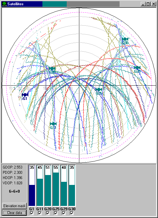
In the sky plot of >24 hours below, the problem area to the WNW is tall trees to around 16 degrees, while the small amount of data below 10 degrees is probably cut-off by choke-ring (makes acquisition more difficult). The bluish paths are GPS while the brownish paths are GLONASS (which reaches further north).
Rob McCaffrey says the Nisqually earthquake moved my station about 2mm S and 1mm W as predicted, and CWU says a few mm S probably also down a few mm.
As described above, DWH1 does NOT have a geodetic-quality antenna mount so do not expect to trust a time-series. However, PANGA/CWU used GIPSY to compute a series which I've inserted below. My hope is that this shows the magnitude of typical expected stability, with approximate expected velocity. Later time-series are available in other places such as SOPAC.

CWU estimated the height of ARP to be around 109.037m, approximate ITRF97 01JAN01 LAT 47.774104307 LON -122.080155154
ESOC analysis
produces SINEX files stored at ftp://cddisa.gsfc.nasa.gov/igex/products/
I stored a series of their results in
a spreadsheet (later added COD
and IGS)
AUSPOS (MicroCosm) estimated ARP in mid-October 2000 to be around 109.054m, 47 46 26.7753, -122 4 48.5588
SCOUT (Gamit) for day 281 of 2000 said
 Site   Latitude (d)  Longitude (d)     Height (m)
 DWH1    47.77410426  -122.08015512       109.0304 WGS84
               X (m)          Y (m)          Z (m)
 DWH1  -2280790.3465  -3638690.4007   4700113.8129 ITRF97
When I run data through NGS' OPUS it says
ARP HEIGHT: 0.0                              OVERALL RMS: 0.020(m)

 REF FRAME:        NAD83(CORS96)                        ITRF00 (EPOCH:2002.2589)

         X:     -2280789.691(m)   0.018(m)          -2280790.366(m)   0.019(m)
         Y:     -3638691.566(m)   0.003(m)          -3638690.386(m)   0.003(m)
         Z:      4700113.697(m)   0.027(m)           4700113.814(m)   0.027(m)

       LAT:   47 46 26.75747      0.017(m)        47 46 26.77540      0.018(m)
     W LON:  122  4 48.50205      0.014(m)       122  4 48.55962      0.021(m)
    EL HGT:          109.374(m)   0.023(m)               109.030(m)   0.025(m)
 ORTHO HGT:          132.584(m)   0.034(m) [Geoid99 NAVD88]

       UTM:          Zone  10
  NORTHING:      5291602.466(m)
   EASTING:       568916.199(m)
I try to combine various results from AUSPOS, SCOUT, OPUS, and Auto-GIPSY into another spreadsheet. Better results are probably found in my summary of IGS analysis referenced near top of this page.